Home
Experience
Cartography
Data Analysis
Database Experience
GIS Experience
>
Toronto Rent
911 Call Data Geostatistical Analysis
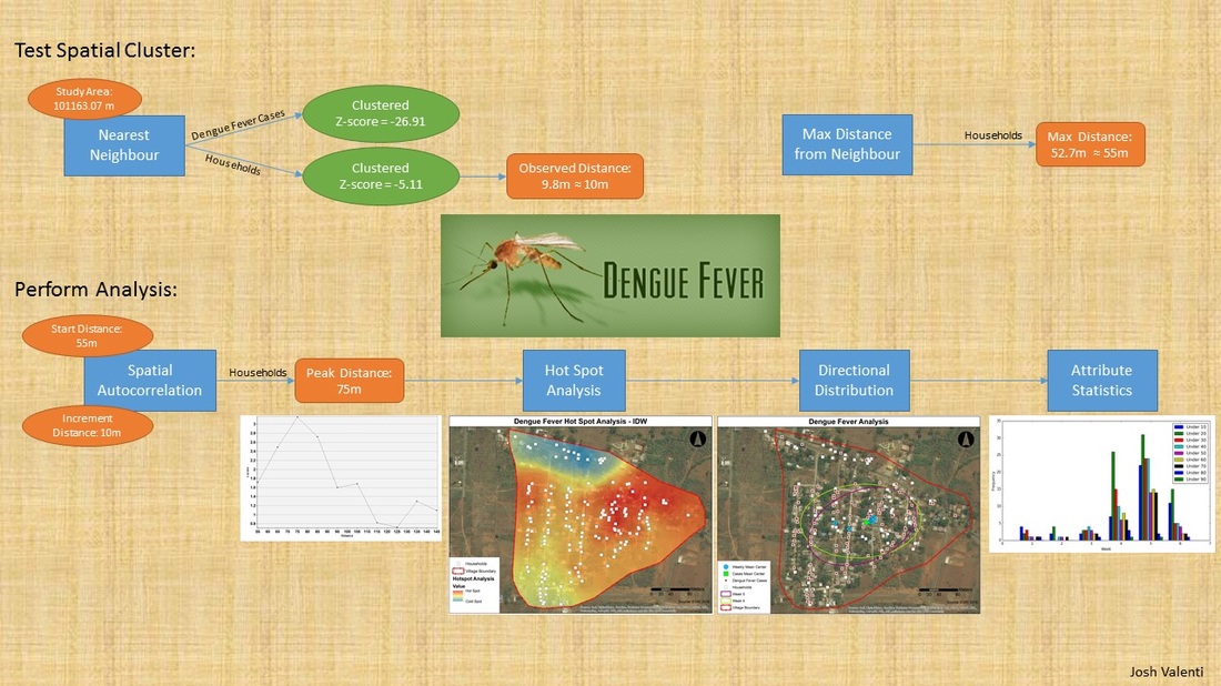
Spatial Pattern Analysis - Dengue Fever
Influence of Urbanization on public transit
Site Analysis of the Town of Gumby’s Landfill
Urban Heat Island
Programming Experience
>
Google API
Python Scripts
Niagara College Thesis
>
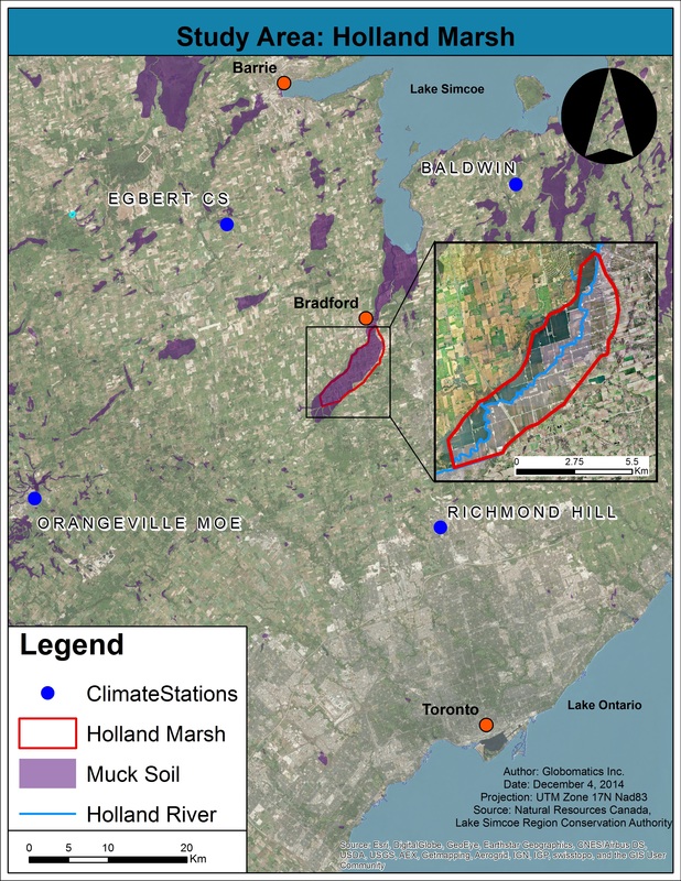
Water Balance in the Holland Marsh Thesis Project
About
Contact
Joshua Valenti
B.Sc., GIS:GM (P.G)
Back to experience
Cartography
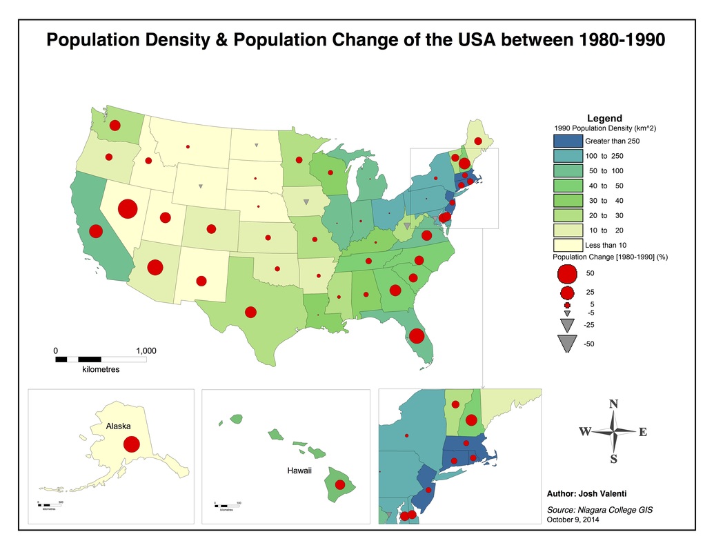
Population Density - MapInfo
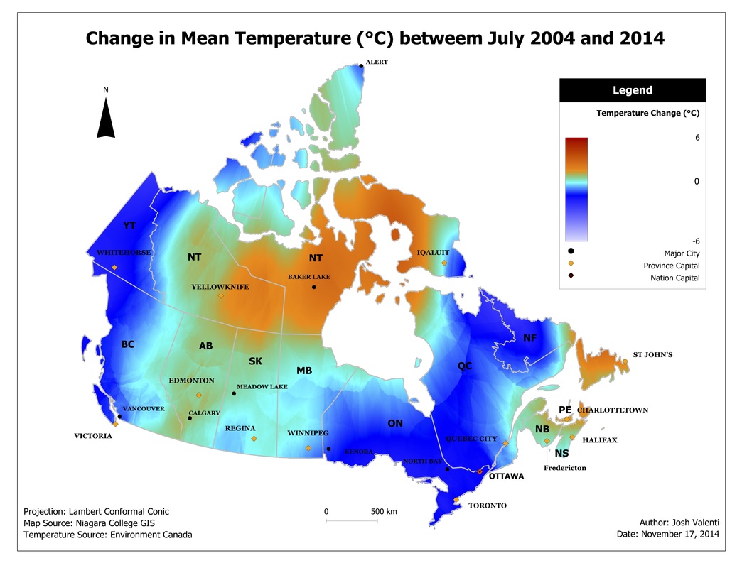
Temperature across Canada - Manifold
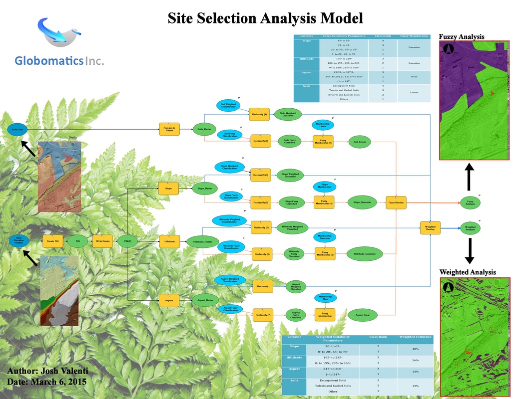
Site Selection Model - ArcGIS
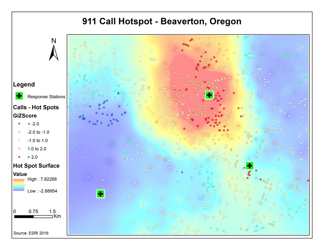
911 Hot Spot Analysis
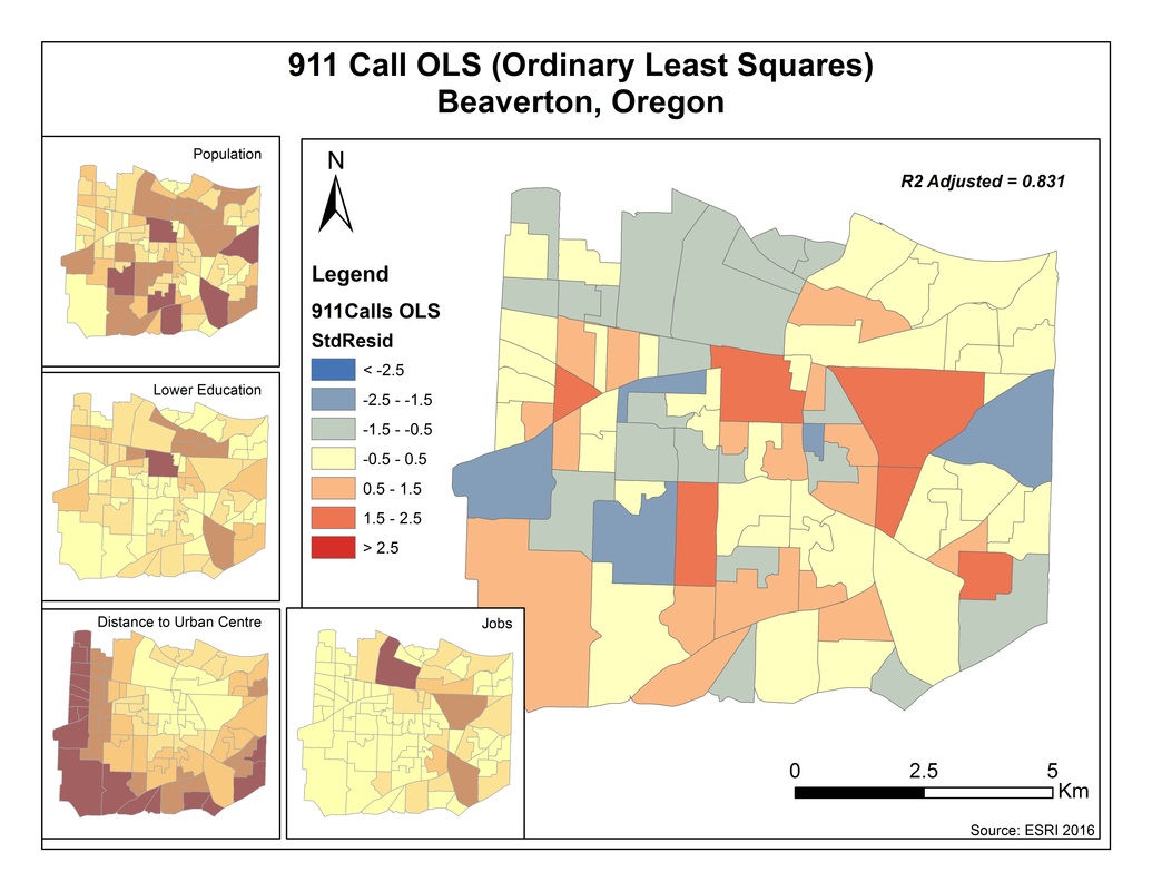
911 Calls - Statistical Analysis: OLS
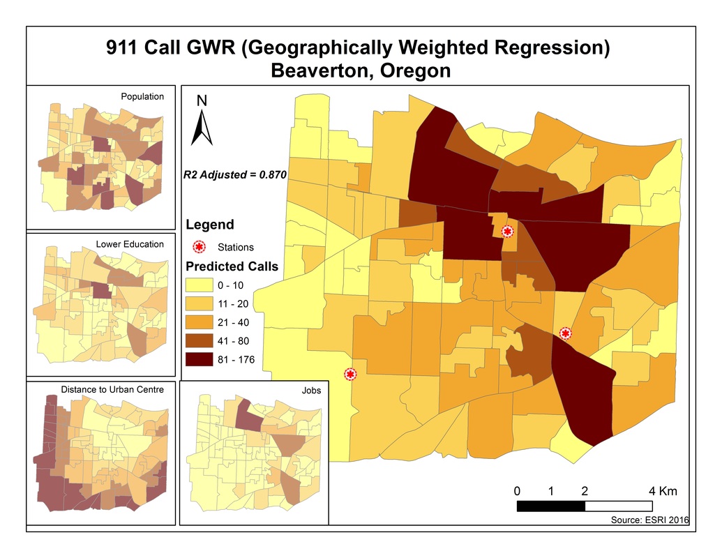
911 GWR Analysis
Dengue Fever Model
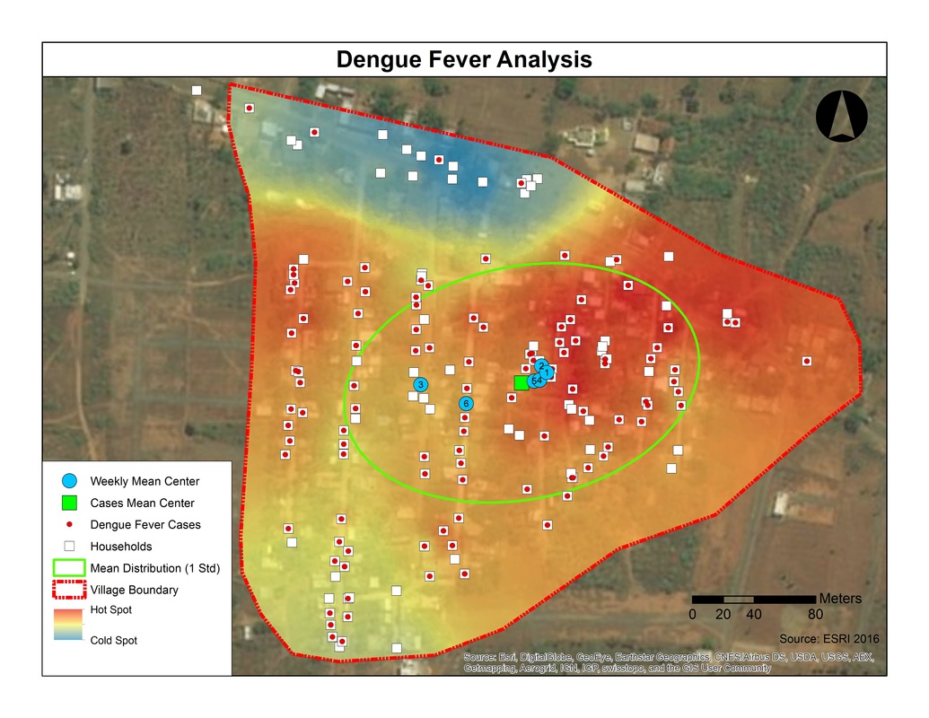
Hot Spot Analysis - Dengue Fever
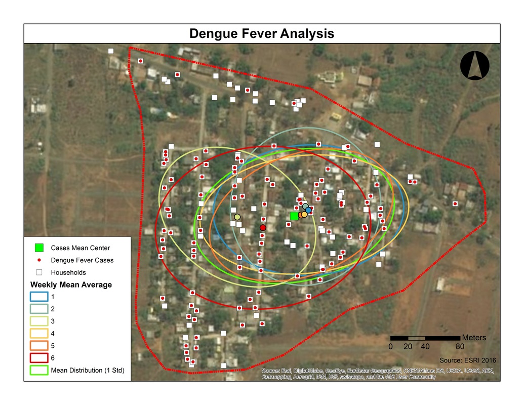
Spatial Distribution - Dengue Fever
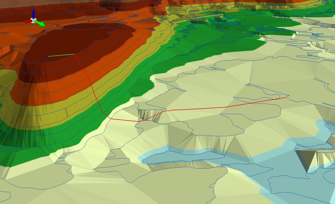
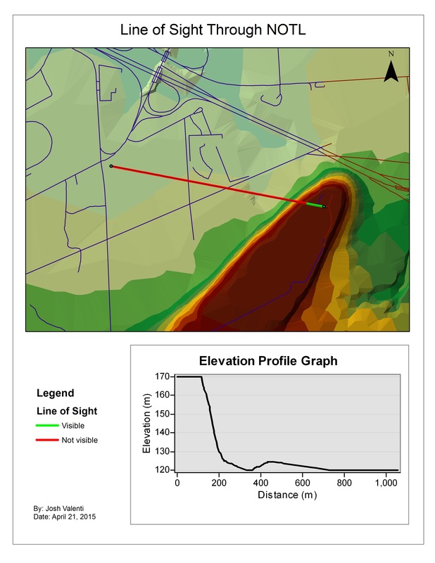
3D Model of Line of Sight - ArcGIS
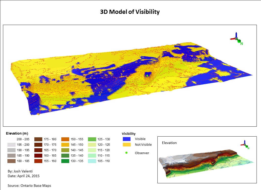
3D Model of Visibility - ArcGIS
Holland Marsh Study Map - ArcGIS
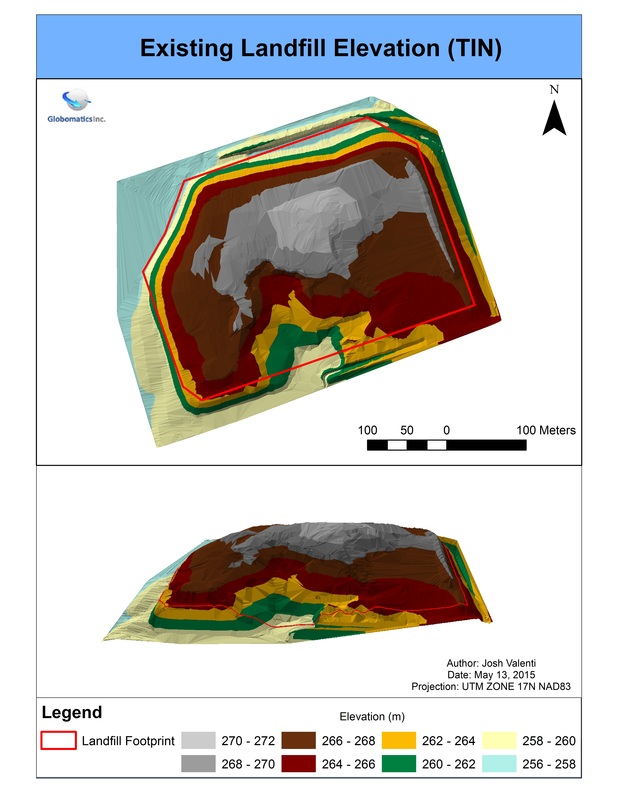
Landfill Map 1: 3D Analysis of Existing Elevation of Landfill - ArcGIS
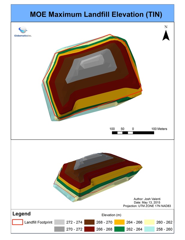
Landfill Map 2: 3D Analysis of Maximum Elevation - ArcGIS
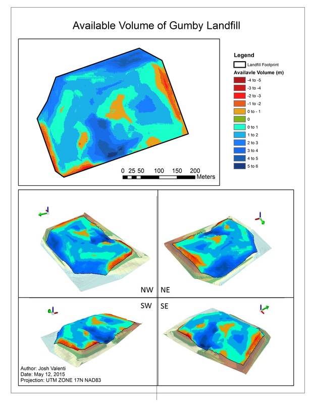
Landfill Map 3: Total Available Remaining Volume - ArcGIS
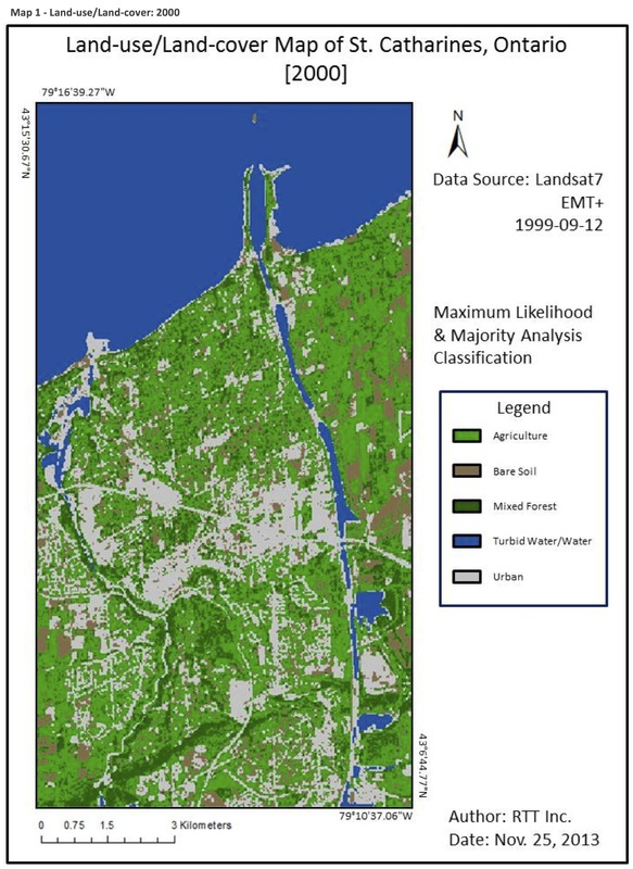
Land-use/Land cover - ArcGIS
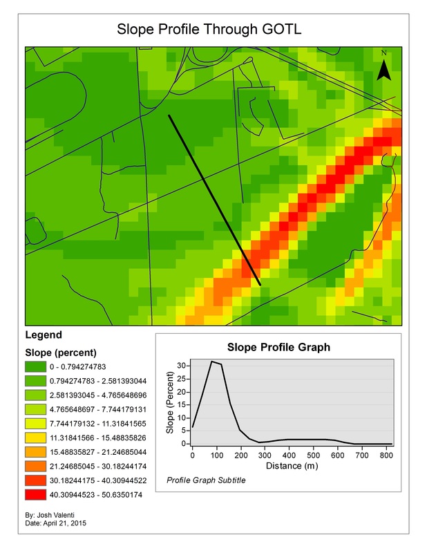
3D Slope Analysis - ArcGIS
3D Line of Sight Analysis - ArcGIS
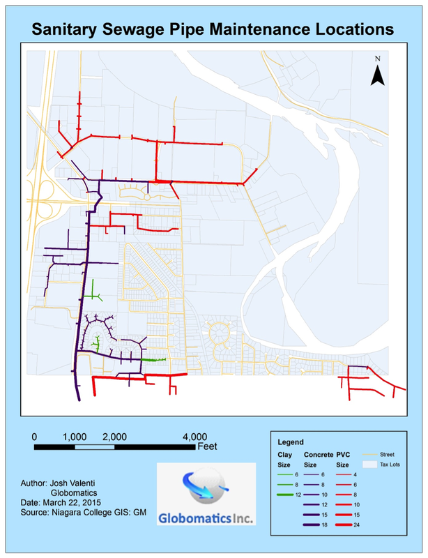
City Sewage Pipes - AutoCAD/ArcGIS
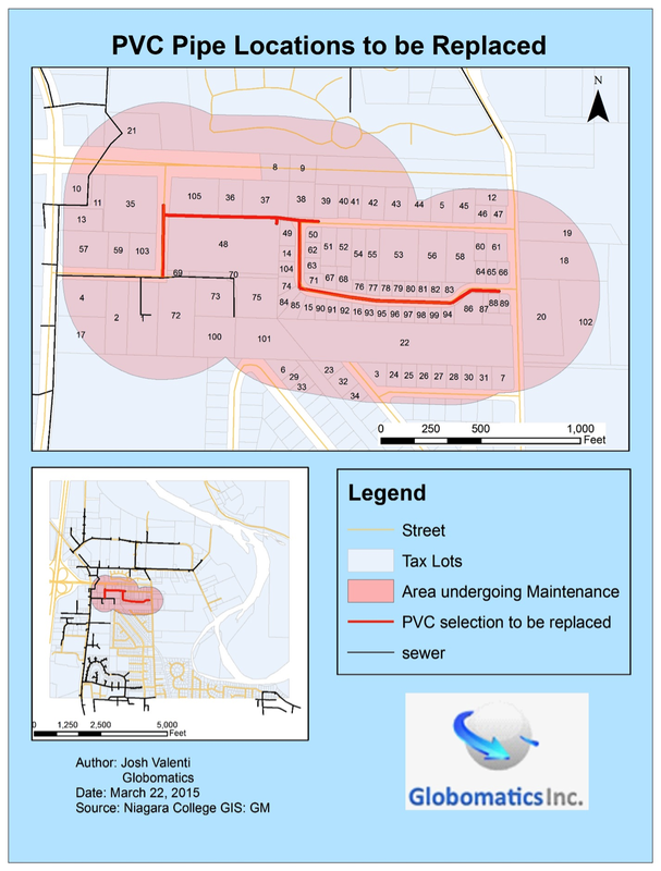
Sewage Pipes for Repair - AutoCad/ArcGIS